You can follow our progress here.
Friday, November 18, 2011
Sydney to Hobart Sponsorship
You can follow our progress here.
Friday, July 8, 2011
Mobile GIS Hardware Review 2.0
 In light of some changes to the hardware market for mobile GIS, a new and improved overview document has been prepared! This document is aimed at providing a concise and informative overview of the devices we recommend and sell, and look at their suitability for field and GIS data capture applications. Specifications and approximate pricing are included.
The document has changed substantially from its earlier incarnation, with some devices removed (such as the now discontinued HP iPaq) and others added. The new Motorola model, the MC65 is a popular new addition to the range. The document is available in PDF format here.
If you require clarification or further advice on the hardware or accessories, please let us know. You can email me at Patrick@riamobilegis.com.au.
ArcGIS for Home Use
ESRI Inc have just announced the new ArcGIS For Home Use Program, making it possible for you to take ArcGIS home with you to work all weekend - yay! All jokes aside, if you part of a community group of some description, then this could be just for you. What you get is:
- A single use ArcView license
- ArcGIS 3D Analyst
- ArcGIS Geostatistical Analyst
- ArcGIS Network Analyst
- ArcGIS Publisher
- ArcGIS Schematics
- ArcGIS Spatial Analyst
- ArcGIS Tracking Analyst
Wednesday, July 6, 2011
Where are we Heading?

The pace of technological change, and hence Spatial and GIS, appears to be ever increasing. At times it's getting harder and harder to get a clear picture of where we are heading .....
We are now mobile & spatially enabled!
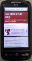
 What are two things that you think of when someone says mobile GIS? To me, it is pretty obvious... mobile, and spatial. Well guess what, our Mobile GIS blog is now both mobile and spatial. Hooray!
Take a look at out blog from your mobile device. Very pretty!
I have also started defining the location of the blogs. What this means, I don't really know, but I have done it anyway :)
Tuesday, February 22, 2011
Mobile GIS Hardware Review
 After several inquiries, a document was prepared in order to provide a clear and concise overview of the most popular units used in the field for mobile GIS applications. It covers a wide range of units, from standard PDAs through to ruggedised laptops, and different brands such as Nomad, GeTac, Panasonic and Xplore. Units have been arranged into classes according to the kind of detailed data they are able to capture. The document also includes approximate prices.
Hopefully this will be a good starting point for people trying to research the best mobile GIS solution for them!
If you would like the PDF, please email me at Patrick@riamobilegis.com.au
Friday, January 28, 2011
ArcGIS 10 GDBT

Wednesday, January 5, 2011
ArcPad 10 Performance Tips
 You might have seen a post that I did back in July (ArcPad Drawing Speed), which compared the drawing times of different datasets using ArcPad versions 7.1, 8.0 and 10.0. This research backed up the claims made by ESRI that version 10 has significantly improved performance over previous releases.
There are a few reasons for this. One of which is a new spatial index that is built in AXF files generated using the ArcPad Data Manager Tools for ArcGIS 10. Unfortunately, if you are still using ArcGIS 9.3, the Data Manager Tools have not been updated, and therefore, you will not receive the new indexing.
There is however a way around this:
- Generate your AXF file using either the ArcPad Data Manager tools for ArcMap, or ArcToolbox tools
- Open up the AXF file in ArcPad 10
- Open the Table of Contents, and open the layer properties of the layer you want to index
- Switch across to the Attributes page
- You will notice that the check box next to the Geometry field will be unchecked. Click it to build the index.
- Click OK on the Layer Properties, and OK on the Table of Contents dialog
- The above is only applicable to line and polygon layers
- The indexing can only be read by ArcPad 10. It will not be used in 7.1 or 8.0


